
We've managed to get a table at one of our favourite restaurants in St Trojan (thanks to us making a booking the previous day...)
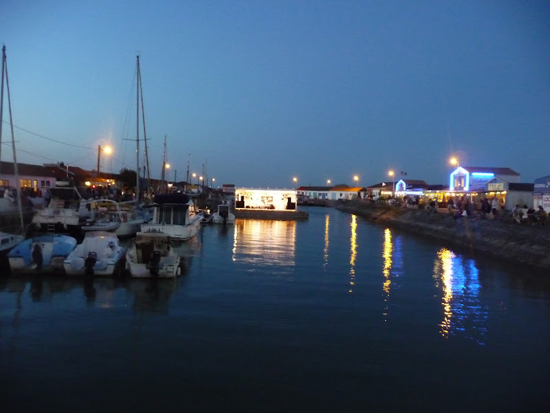
And the stage for the evening concert was set up right in front of us

It was on a movable flot which was finally turned on the water that people eating at restaurants on both sides of the port can enjoy the concert


Above: one of the restaurants on the other side
Below: the stage on the water

We've decided on our last day, as the weather was not so good, to explore the north western part of the island. It is more rocky than than the other beaches, but we found an interesting concept - take a careful look at the photo above: you'll notice the bow shape of the rocks furthest from the beach. It is part of Les écluses à poissons (sluices to fish) which you'll find not only here but also at île de Ré and Noirmoutier. The earliest writing you'll find about it dates back to the 14th-c although it is believed to be much older, probably dating back to the Gallo-Roman era. The walls are constructed from rocks found in the area and have openings with, previously wood, and now metal gates in it. Before the islands were linked by bridges to the mainland, life was very tough on the islands and this concept made it easier to fish, as the water (with the fish) entered through the openings and the people could take out more fish.


When leaving île d'Oléron to return for another 2 days at Fouras before heading home, JL decided to take me on another road that I do not know. We've passed through Brouage with its ancient fort, which we have visited the first time I've been to Fouras. Today surrounded by land, it was an important port at one stage and a Catholic stronghold, as Richelieu wanted it to compete with the Huguenot La Rochelle. It is a military town of origin with very square streets, not the narrow winding roads you'll find in villages/towns that originated in the Roman era. Samuel de Champlain, founder of Quebec in Canada, was born in Brouage and the memorial below, in front of the church, is dedicated to him.


Very square streets...
And the outer wall surrounding the village


We continued to île Madame, the smallest of the four islands in the region (400x800m). You can access the island by car when it is low tide and we arrived just at the good time. Even though I was a bit worried as we drove on the wet rocky road...


The island is very involved with aquaculture and oyster farming, as well as salt harvesting.
One has a beautiful view of Fouras from île Madame, with fort Vauban a prominent feature


île Madame has a small beach
One has to take care, as you can be cut off on the furthest part of the island and covered by water once it is high tide (the region is subject to huge differences during high and low tide). A rescue platform was built (below, on the left, the right if fort Broyard) in case you misjudge the tide and are caught by the water

The warning sign and explaining that you should use the rescue platform in case being caught by the tide...

No comments:
Post a Comment